Buggerru, Pan di Zucchero, and Porto Flavia: Sardinia’s Mining History
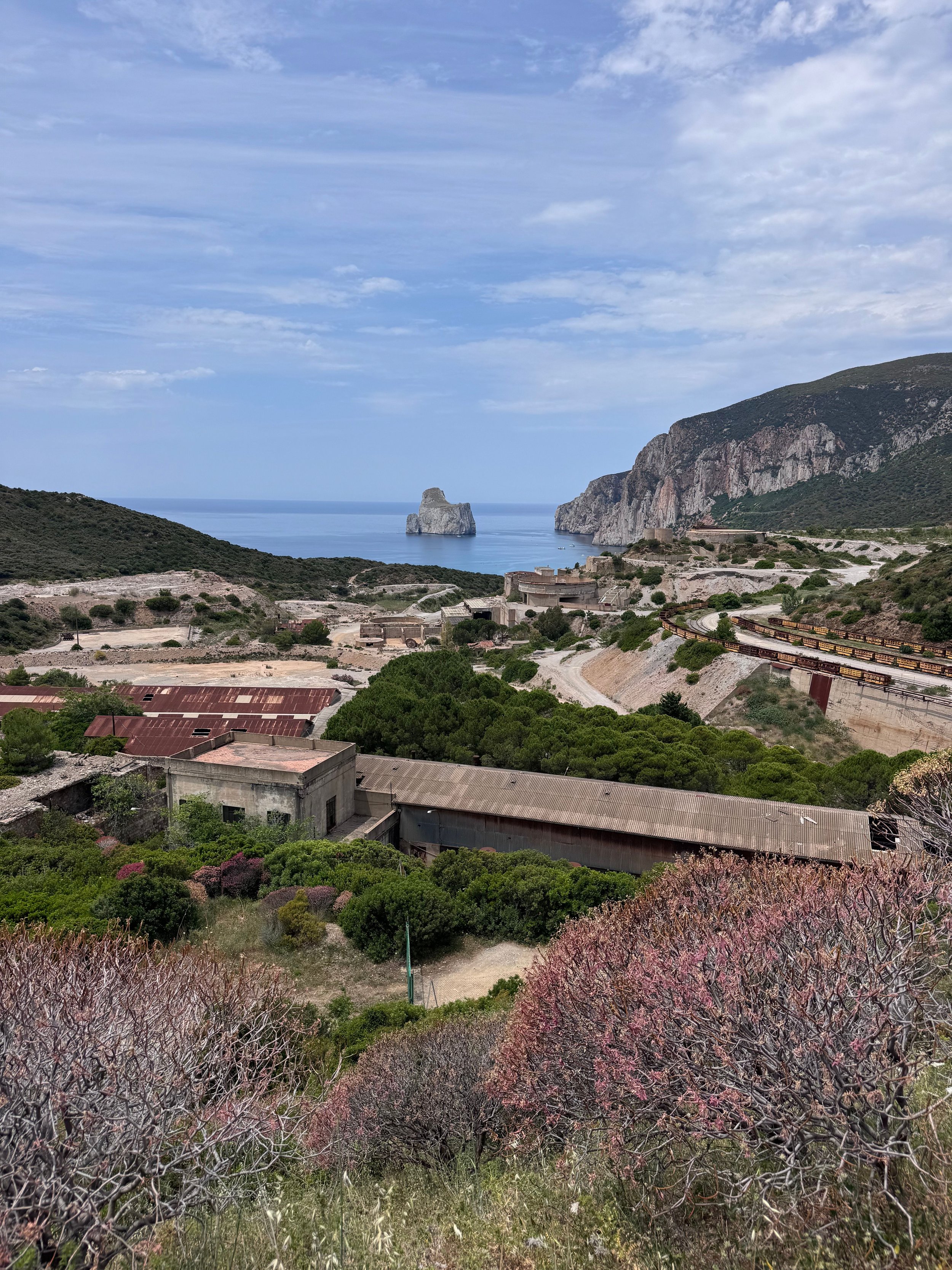
Sardinia is famous for its beaches, but along the southwest coast lies a landscape that tells a completely different story.
A story of miners, engineering marvels, and a rock formation that ranks among the island’s most photographed spots. This is the Sulcis-Iglesiente region, and it certainly deserves a spot on your itinerary.
Pan di Zucchero: the silhouette of the coast
Pan di Zucchero
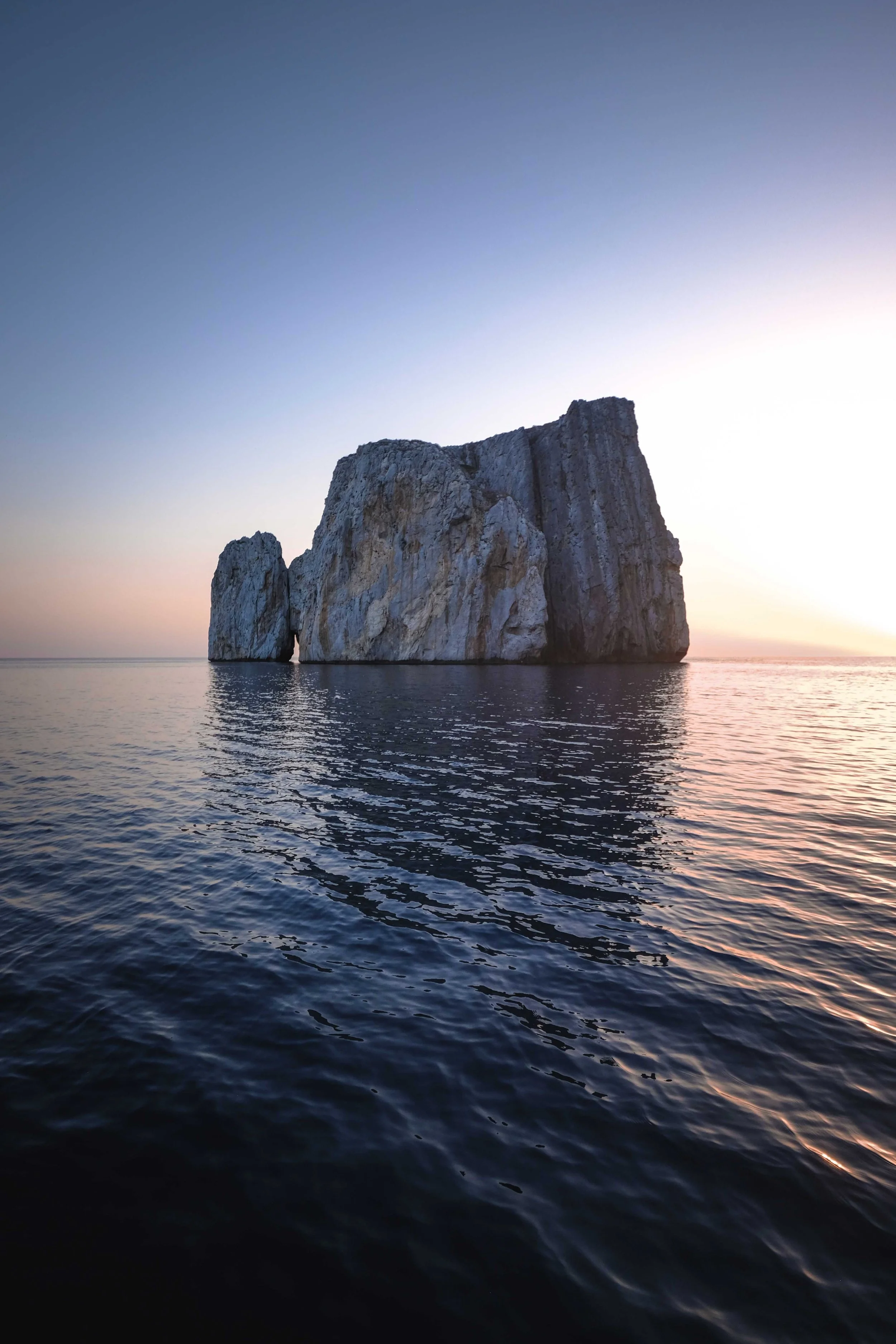
Off the coast of Masua and Nebida, a series of limestone rock formations rises from the sea. The largest and northernmost of these is the Pan di Zucchero (Sugar Loaf Rock)—a natural monument 133 meters high, covering an area of nearly 4 hectares.
The rock consists of an almost pure, waxy limestone, with occasional yellow patches of dolomite. Two smaller, similar rocks a little further south are called S'Agusteri and Il Morto.
The silhouette of Pan di Zucchero, as seen from Masua Beach, is one of the most recognizable sights in southern Sardinia. That is why this relatively remote stretch of coastline still regularly appears in photo frames depicting the island.
Porto Flavia: Mining as an Engineering Art
Porto Flavia
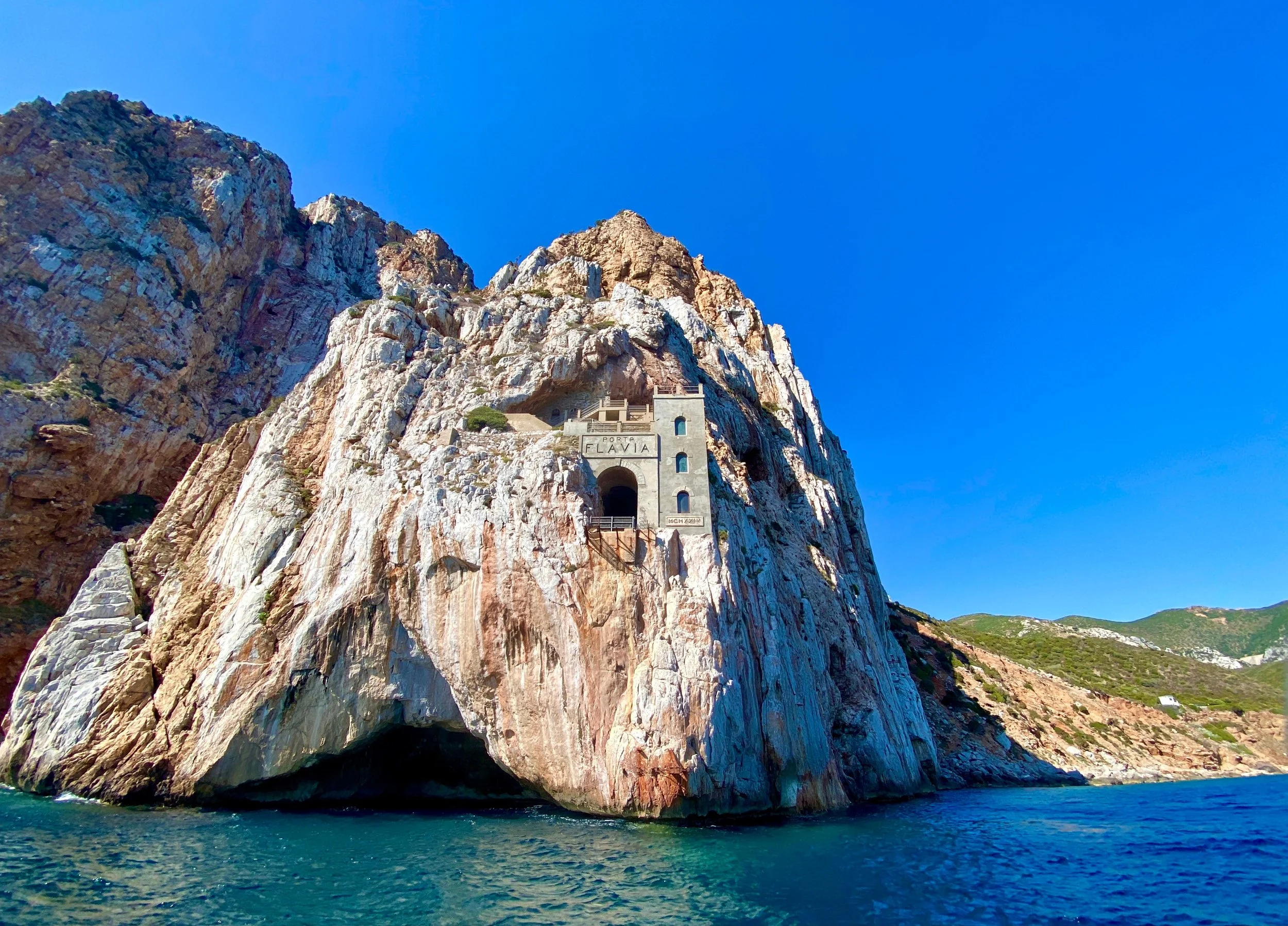
Directly across from Pan di Zucchero, tucked away in the cliff face, lies one of Italy’s most remarkable examples of industrial archaeology: Porto Flavia.
This structure was designed between 1922 and 1924 by the Venetian engineer Cesare Vecelli, commissioned by the Belgian mining company Vieille Montagne—and named after his daughter, Flavia.
Vecelli's idea was radical for its time. Instead of transporting ore to Carloforte by small boats, he had two tunnels, each 600 meters long, dug one above the other, connected by nine vertical silos, each with a capacity of 1,000 metric tons.
In the upper tunnel, a small electric train transported the ore to the silos, where it fell downward by gravity. In the lower tunnel, a 16-meter-long extendable conveyor belt loaded the ore directly into the ships anchored beneath the rock face. What used to take days now took only a fraction of the time.
Porto Flavia remained in use from 1924 to 1963, for nearly forty years.
What You Can Still Visit
The Porto Flavia tunnels themselves are now open to the public on guided tours. You walk about 600 meters through the tunnel that was once carved out by miners, and emerge onto a terrace that hangs high above the sea—with a breathtaking view of the Pan di Zucchero.
The Ghost Town of Masua Behind Masua Beach lie the remains of the former mining village: homes, a school, a hospital, a church, and workshops. It is not a site that has been completely turned into a museum—you can walk freely through the streets and paths that crisscross the village.
Cala Domestica
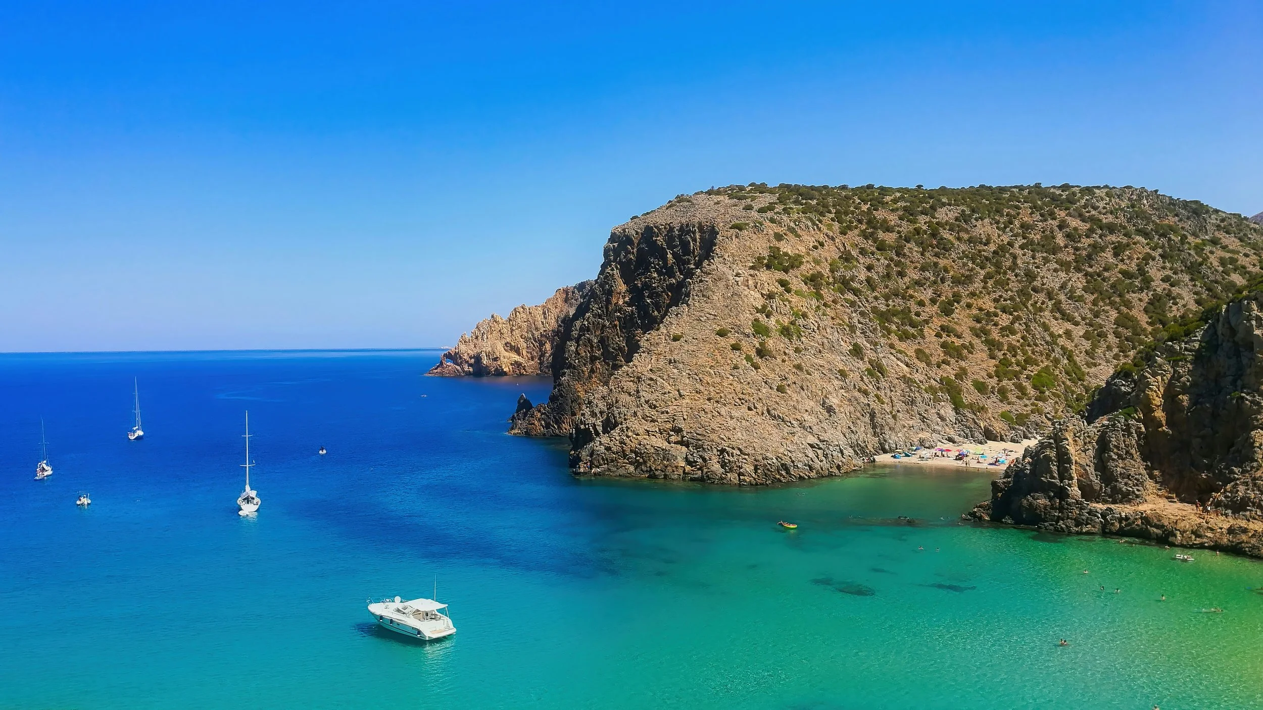
Cala Domestica, near Buggerru About ten kilometers further north, in the Buggerru area, lies Cala Domestica—a deep cove between two steep cliffs, with amber-colored white sand, an Aragonese watchtower on the left headland, and the remains of an abandoned mining loading station. Until 1940, ore from the mines in the hinterland was shipped out from here.
The Cammino Minerario di Santa Barbara Cala Domestica lies along a well-known hiking route: the third stage of this official trail, which connects Masua to Buggerru via Nebida. At 19 kilometers long with an elevation gain of about 700–900 meters, this is one of the more challenging stages of the entire trail, but also one of the most beautiful—along the way, you’ll pass a panoramic view of the Pan di Zucchero from the summit of Monte Nai, the small bay of Canal Grande with the Grotta delle Spigole (a long sea cave), and finally Cala Domestica itself, before the trail descends further to Buggerru via the Galleria Henry.
Prefer a shorter hike? From Cala Domestica itself to Buggerru, there’s a separate, shorter route of about 8 kilometers, which can easily be completed in half a day.
The broader context: a protected mining landscape
Masua, Nebida, Buggerru, Iglesias, Gonnesa, and eighty other municipalities are part of the Parco Geominerario Storico e Ambientale della Sardegna—a vast protected area that preserves the island’s industrial heritage.
In addition to Porto Flavia and Masua, anyone interested can also visit the mines of Monteponi, Rosas, and Serbariu, each with its own story about Sardinia’s mining history.
Practical Information
Directions: From Cagliari, it's about an hour's drive to Masua.
Guided Tours A visit to Porto Flavia takes about an hour and is always guided. Expect a walk of about 600 meters through the tunnel.
Combined with a trip to the sea: From the small harbors of Masua or Buggerru, excursions depart by rubber boat or sailboat, sailing along the entire “Mines Coast,” right beneath Porto Flavia, all the way to Cala Domestica or the caves of Santa Barbara. It’s a wonderful way to see the structure from the water, which, according to experts, is even more impressive than from land.
My insider tip
Combine a visit to Porto Flavia with a short walk along the trail between Porto Flavia and Nebida. It offers views of the entire coastline and is much quieter than the immediate vicinity of the main attraction itself.
Would you like to combine this mining landscape with other places in southwestern Sardinia, or are you wondering how best to fit this into your itinerary? I’d be happy to help you figure it out.